
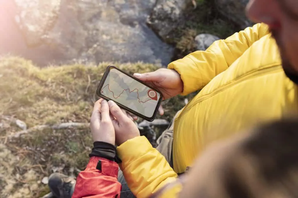
Best GPS Hiking Apps For Navigation [2024]

GPS Hiking Apps
Super high-tech navigation is no longer just for professionals or the military. Since the iPhone 2 introduced GPS into its device in 2008 many Apps have appeared which help you navigate your walks & hikes.
Thanks to mapping services like OpenStreetMap, MapBox & Google Maps, any App developer has access to maps to build into their software.
This basically means that anyone that has a smartphone can navigate without having to buy a dedicated GPS unit.
In this post, I’ll be reviewing the top GPS hiking apps for mobile phones.
GPS Accuracy
If you’re wondering how accurate GPS can be on your smartphone, the official figure is 4.9 metres (16 feet) when you have an open sky. Any obstacles like buildings and trees will affect this and it may be a little less reliable.

Key Features Navigation Apps Must Have
There are a number of key features that you would expect a GPS navigation App to have.
These are my top 9 features:
A clear map with a direction arrow of your current location.
Navigation/Voice commands/Alerts.
Trail search/route discovery.
Trail information/photos.
Trail recording.
Walking pace stats.
Distance walked stats.
Elevation profile of your hike.
Route planning.
Key Feature Notes
Here are some extra important features that may be important to you.
Paid vs FREE features
Some of the Apps reviewed come with more standard features than others. Of course, we all want things to be free, but sometimes paying for extended App features can be well worth the small amount it costs.
We are lucky that phone Apps hardly ever cost more than a few £/$ per month so it’s very economical to use the pro features of many Apps these days.
Trail Discovery
One great feature that most Apps have these days is the ability for users to save and share the routes they walked – basically the social aspect. This allows Apps to have content far beyond what the creators could produce by themselves.
One thing to consider with user routes available is the country you are hiking in. Different Apps have different popularity in different countries, so some Apps have better content in specific regions.
In addition to the above, highly specific walks sometimes have dedicated Apps just for that walk. An example of this is the Camino de Santiago in the north of Spain (example App – CaminoNinja).
The Best Hiking Apps
Take a look at the list below. Each App is slightly different and I’ll review each one in the rest of the article.
Komoot
Outdoor active
OS Maps
All Trails
Wikilock
Gaia GPS
FootPath
FarOut/Guthook
Visorando
Hiking project
Trail Smart
Trail Forks
National Park Trail Guide
Hiiker
Strava
My Top Picks
Different Apps are good for different things. Here’s a quick list of what stood out for me.

Navigation/Voice commands/Alerts: Komoot, OutdoorActive (check others)
Trail search/route discovery: Komoot, All Trails, Hiking Project, TrailForks, Hiiker, Strava (paid only).
Trail information/photos: All Trails, FarOut, Visorando, Hiking Poject,
Trail recording: Strava, Komoot
Elevation profile of your hike: AllTrails
Route planning: Strava Paid, Footpath, Komoot, OutdoorActive, Gaia
Specialist Maps: OS Maps,
Hotspots and amenities on maps: Outdoor active, Hiiker, FarOut, TrailSmart, National Park Trail Guide
Extra map overlays: AllTrails, Gaia, TrailForks
Free App with best features: Komoot, All Trails, Wikiloc, Hiking Project, TrailSmart
Verified trails: FarOut, Hiiker, Visorando, TrailSmart
Long-distance hikes: FarOut, TrailSmart
Country Specific Apps
If you’re looking for route discovery, here’s a quick breakdown of which Apps may suit you best based on where you are hiking:
UK: Komoot, All Trails, Wikiloc, Visorando, TrailForks, Hiiker
Spain: Wikiloc, TrailSmart (Camino de Santiago)
Portugal: Wikiloc
France: Visorando
US: FarOut, Hiking Project, TrailForks, National Park Trail Guide
Each Hiking App Reviewed
In no particular order, these are my reviews:
1. Komoot Hiking App

Komoot is a multi-sport App created for hiking, cycling & running. The name is based on a play on the word “commute” having supposedly been first designed for more city use.
From my own personal experience, I’d say that Komoot is one of the more popular Apps out there.
Let’s explore why.
The Komoot App is set up in a simple way with 4 specific sections: Discover, Plan, Record and Profile where you are able to access planned or completed routes.
Discover
The discover section asks you what to do between various outdoor activities. When you select hiking you get options to “start where you are”, “explore nearby”, “explore worldwide” and “search”.
Each of these options gives you a great way to be more specific with your search.
You’re then able to narrow down your search between tour duration, difficulty and start point.
The result of your search will bring up all the trails walked by Komoot’s users in that area. You’ll be able to see photos, a description of the walk, history and hike stats such as length and elevation gain.
Plan
The “plan” tab on the Komoot App is as it sounds. You can basically use your finger to click on the screen and add points onto the map or use the search bar to find locations and add them as part of your route. The great thing about the plotting with Komoot is that the lines stick to known pathways rather than going wherever you click – on some Apps you can draw through a lake or building which isn’t helpful.
Record
On the record tab, you just hit record and you will see your route traced on the screen. You’ll see your current speed, distance, ascent and other hike stats. You can also create a highlight along the way and add photos. This is especially useful for people who may follow your route in the future.
You can switch between the Komoot map and a satellite map provided by MapBox. In the premium version, you’ll also be able to add different layers/filters to the map.
Planned Route
You can access planned routes from your profile tab. A simple tap on “Navigation” will start the turn-by-turn voice navigation for any saved trail or route. This is an especially useful feature of Komoot which most Apps don’t have. Although in my opinion, it’s entirely up to preference whether you have a voice-led route. This feature becomes extra useful if you use the App for other sports as well like cycling.
Free vs. Paid Subscription Options
I really like the Komoot App because the features are very reasonably priced. The subscription actually comes in 3 levels.
In the free version, you can discover and plan tours and also use basic navigation. You also get one “region” for FREE so you can try out some paid features – see the following…
When you unlock “regions” you get Voice navigation, Offline maps, and Tour export for your GPS device. As mentioned above, they give you the first region for free and suggest you select the area in which you live to test it out. You can then purchase other regions or world maps for one-time prices which in my opinion are extremely cheap and I’d definitely go for them.
The second paid option is Komoot Premium. This is their subscription service which adds extra data to the App. You get things like a hiking-specific map layer, real-time weather updates and planning multi-day tours.
Komoot Summary:
Special features to note:
Tour weather
Multi-day hiking feature
It can report what percentage of a route consists of a given surface (roads, cycle tracks, gravel).
Turn-by-turn navigation: Yes
Free features: Discover, plan and record, navigation in your selected free area.
Paid features: Specific hiking map layers, world maps.
Special features to note: Great voice navigation, route surface data.
Which map does it use? OpenStreetMap & MapBox (satellite).
Users: ?
Pros: Cheap to use most paid-for features (one-time payment). Great all-round App.
Cons: No major cons.
Komoot Rating:

2. Outdoor Active App

OutdoorActive is really nice navigation and planning App with free premium maps and boasts over 35,000 trails.
On the home screen of the App, you get 5 tabs to explore. Map, Plan, Track, Discover, Profile.
The Map allows you to search across the world and find everything from accommodation to places to eat and drink. I particularly liked that you can see tourist spots on the map. You can also scroll down to see a history of an area and highlights of things to do.
The Plan tab allows you to tap and hold on the map to insert and start and endpoints. As mentioned a few times in this article, this kind of feature isn’t always good with hiking Apps, so this is a big plus point. I also like that you can split the hiking type into 5 categories including pilgrim walks and nature trails when creating the route (This helps other people filter the hike if you share it later on).
“Track” allows you to record your walk or hike. I really liked the “My Map” feature where you can add your own overlay of saved points of interest (this does require a pro subscription though).
You’ll also be able to see your walking stats such as speed and total time.
The Discover tab is the “digital home for experiencing the great outdoors” as quoted by the App.
I didn’t find this tab very useful at all. There just seemed to be guides to places all over the world that weren’t near me and there doesn’t seem to be a search bar. Also, some of the routes are for premium members only. That said, after a while, I worked out that the best way to search is from the Map tab. Search the area you want and filter for routes (instead of food, services, webcams etc…). You can then either see icons on the map for routes, or select list view which I found easier.
On the My Page tab, you can access your saved routes for navigation which offers voice directions as well.
In general, I really liked this App – especially as you don’t need to pay to use many of the features up-front.
Special features to note:
Accommodation search
Winter map layer
Audio information guide for areas (although I didn’t find any).
Create your own map overlay (pro version)
Identify peaks with skyline (pro version)
Turn-by-turn navigation: Yes
Pricing Structure: Free, Premium, Premium Pro
Free features: Discover, plan and record, navigation, voice navigation.
Paid features: Lots of extra layers, skyline, too many to list.
Special features to note: Accommodation search, audio guides, custom map overlays.
Which map does it use? OpenStreetMap & many country-specific like OS, French & Swiss maps.
Users: ?
Pros: Lots of map types, layers & styles. Ability to create your own layer (pro version). Identify peaks or landmarks with skyline. Premium maps are free. Audio guides.
Cons: Some things confusing at first. Doesn’t search postcodes. In-App ads.
Outdoor Active Rating:

3. OS Maps App

“World-renowned maps that cover the UK as well as the USA, Australia and New Zealand”. The Ordinance Survey (OS) was founded way back in 1791 as Great Britain’s mapping agency. Does this mean that they have the best App? Let’s find out…
On opening the OS Maps App you get a simpler screen than most other Apps – just a map. What you see on the map depends on what type you’ve selected (standard, topo, aerial) or any of the additional map overlays you have opted for (e.g. cycling).
The App uses MapBox, OpenStreetMaps and the OS’s own data to create the maps. You’ll see in a bit that this is really where the App shines!
Firstly, when you come to use the OS App, you have two options – either go to “menu” in the top left where you can plot a route, record an activity or find a route. The premium version also has a cool Augmented Reality feature which you can use to point at landmarks to discover what they are or fly through your route before you even start it. Alternatively, you can click the squiggly line (find routes) icon on the map itself to quickly bring up the “find routes” option.
I really like the interface of the App – it’s very clean and easy to use. Being an OS map, the detail is incredible. You see all the tiny paths and walls on the map that you sometimes wouldn’t see. You get the 1:25,000 scale maps which means that every 4cm on the map is 1km in real life. This is great if you’re trying to follow your own route, and even better in difficult terrain where you’d like to avoid things like marshland.
The route plotter in the OS Maps App doesn’t snap to paths in the free version which makes this feature much more difficult to use. You can draw straight through lakes or buildings for example. I do like though how you have a high degree of control over how you make a path. E.g. you can adjust the thickness and opacity of the line so it doesn’t obstruct what’s underneath so much. Thinking about it, the App is designed for being highly specific in creating your own off-road trails, so maybe this is why they didn’t build in the ability to “snap” to marked paths unless you go for the paid version of the App.
The “find routes” function is nice and simple. You can select what type of activity you want to do (even paddling), trail length and difficulty. Then the number of routes for that area appears on the map. After that, you just click to visualise the route you would like to do.
Although this is nice and simple, it does lack the extra community features that Apps like Komoot offer. For example, there are no photos or user descriptions of the route. There also seem to be fewer routes than Komoot offers which is an obvious disadvantage.
The App doesn’t offer turn-by-turn voice navigation which for some can be a deal-breaker. It depends if you want to use the App for other things like cycling as well.
One stand-out feature of the OS maps that I haven’t seen before is that you can print the route (from your computer), which is great as a backup or if you want a bigger version of your map.
OS Maps Summary:
Great for making your own routes and great detail of maps. If you’re a hiking pro who likes following paper maps, this App is a great alternative. The details are second to none and you can print the map anyway if you like. Good for UK, USA, Australia and New Zealand.
Turn-by-turn navigation: No
Free features: Find routes, record activity, plot a route (but no snap-to-path), print map.
Paid features: Snap-to-path plotting, augmented reality and fly-through, offline maps.
Special features to note: Great map detail and nice interface.
Which map does it use? MapBox, OpenStreetMaps, OS Explorer & Landranger
Users: ?
Pros: Nice interface, great for pros, map detail, map printing.
Cons: No voice navigation. Some standard features charged for (snap-to-path), lack of user contributions, limited countries.
OS Maps Rating:

4. AllTrails Hiking App

All Trails is a hiking App with a lot of funding behind it and has over 20 million users.
The App opens to the “Explore” page where you can search or browse trails. Like most Apps, you can also filter by various metrics such as trail type, distance & difficulty. You can also switch to “map view” in the top left of the App. This allows you to quickly scan across the world and see how many trails are available in that location. This is a feature available in the OS maps App, but as noted in that review, there were limited trails. Due to its large user base, AllTrails instantly has a huge number of trails available to you. Plus you get photos too
The Explore page is very user-friendly and the first trails that show up are the ones nearby if you have location enabled. Each trail also has user reviews which are likely to highlight anything specific you need to know about it and WHEN it was left (for recent changes to the trail). Another feature I really like is the ability to run your finger along the elevation profile of the route and see where it corresponds to on the map route.
The map types and overlays are extensive and there are some really cool options. You get the standard AllTrails map, but have options for satellite, US Topographic map, Terrain maps, Cycling map, Street map and Parks map – all for free. The pro version also allows you to add extra details to your map like weather, air quality and light pollution.
There are a few tabs at the bottom of the App, so I’ll go through them separately.
“Community” allows you to connect with friends and see their hikes. You can also access your walked routes here too.
“Navigate” allows you to follow a saved route or record a new one. A disadvantage though is that there is no voice navigation.
“Saved” is your access to favourites, activities and completed trails.
“Profile” gives you all the options you’d expect including access to overall stats from your walks, hikes and activities, like total distance.
I really like AllTrails as an App for hiking. You can see the funding and effort that’s gone into it. The community feel of the App is great and this automatically means that a lot of new trails are uploaded. If you want to use pro features, the pricing is good value at £29.99 per year (£2.50/month). You get the ability to use maps offline, use 3D maps, get extra map layers and alerts when you take a wrong turn. The company have also acquired several other hiking Apps over the years, so more features are likely to be integrated.
Unlike other Apps, I couldn’t see a “plot route” option within the AllTrails App, although you can do it on their website. The features there seemed pretty intuitive and felt nice to use. It also has “smart routing” which allows you to let the App stick to known ways.
AllTrails Summary
AllTrails is a great hiking App that offers lots of routes to choose from. It also works well in lots of countries. There’s no voice navigation, but you do get alerts in the pro version if you go off your trail. You can plot routes on their website, but not in the App which is a small let-down if you’re wanting to do this on the go.
Turn-by-turn navigation: No
Free features: Route planning, lots of maps, lots of user routes.
Paid features: Weather details on map, off-route notifications, offline maps.
Special features to note: Weather & air pollution map overlays on pro. Big user community.
Which map does it use? ?
Users: 27 million
Pros: Lots of maps to choose from. Good free features. Loads of user routes to follow. Works in many countries.
Cons: No route plotting within the App. No voice navigation.
All Trails Rating:

5. WiKiloc Hiking App

Wikiloc is a popular hiking App with over 10 million users and 36 million uploaded trails. The wide user base means that most countries are covered and there’s a good chance you’ll find something near you wherever you are.
Similar to AllTrails, Wikilock opens to an “Explore” page. Here you can search for trails in “list” or “map” view depending on what you find easiest, or toggle between the two.
There are a LOT of trails to choose from which reflects the large user base.
If you want to change the map type, you have options between satellite, terrain, OpenStreetMap and OpenTopoMap (topography) – all for free. Going pro allows you to use maps offline.
Filters when searching for trails include distance, elevation gain and difficulty. You can also use premium features which allow you to filter for when the trail was recorded.
I like the extensive list of trail types as well. You can even filter for things like “blind” or “flora observation”.
Switching from the “Explore” tab, you have the “Record Trail” tab. Here you can record your trail. Some of the features here are:
Take a photo without leaving the map
Compass icon
Centre map button
You can also quickly toggle to stats view to show tonnes of details about your hike like distance, speed etc…
The “profile” tab allows you to see trails you’ve walked, saved trails and App settings.
Let’s say you want to follow a trail…the first option you get is to “send to your GPS device” or “Navigate Trail” through the App. This is a nice feature if you have a dedicated GPS device (only in the pro version of the App). You can also click a button to get “Driving direction to tail head”. This opens Google maps with your route which is a very useful feature as you are unlikely to start your trail from your doorstep.
The negative of Wikiloc is that you have to have the premium version to navigate a trail from the App. It is very good value though at £9.99/year (£0.83/month). If you’re using the App regularly then the cost is negligible. As mentioned above, you get the option to send your route to a GPS device, but this is also part of the premium version.
You can however navigate “Promoted Trails” for free. These are trails that specific companies or areas have registered and paid for. This is a beneficial feature if you’re inside some kind of reserve or organisation that wants to use Wikiloc as their trail guide without having to create their own App.
When using the navigation feature there are no voice commands though – only voice prompts if you leave the trail and this is on the pro version only.
If you do want to download the GPX file, you can actually do so for free through the Wikiloc website and upload it into another App such as Komoot which (as mentioned in the review) will navigate and give you turn-by-turn voice commands.
When you do a search, the Wikiloc App shows you how many trails were found. Some quick results for comparison show that Wikiloc is highly used in Spain!
Spain: 21,000,000
Great Britain: 210,000
USA: 278,000
Portugal: 871,000
Canada: 116,000
There is no trail plotting on the Wikiloc App, however you can do it through the website – “Draw Trail by Hand” in the “Upload Trails” section. However, it does seem pretty basic and the route you draw doesn’t snap to the paths – I drew a line straight through a football stadium.
Other features the Wikiloc App offers are trail weather (free), and live tracking which comes with the pro version. This enables you to share location with friends or family either for safety reasons OR if you are doing a race and you want them to know which stage you are currently at.
Wikiloc Summary
Wikiloc is a great App for finding trails – 36 million and counting with filters to find exactly what you want. This makes it great for people with specific hobbies – like flora observation. You can only navigate sponsored maps for free, although the subscription is very cheap (£9.99/year). A lot of people seem to use Wikiloc to find trails and often export the GPX file through the website for free. Another reason you may want to do this is that the App seems to be more battery-hungry than some others. Wikiloc also seems to be extremely good for Spanish users or tourists visiting Spain as there are over 21,000,000 routes there!
Turn-by-turn navigation: No. Also only sponsored standard navigation routes are free.
Free features: Discover, record, follow your trails, follow sponsored trails.
Paid features: Following most trails, audio cues, live tracking,
Special features to note: In-App weather, audio cues, specific trail filters such as flora observation.
Which map does it use? Google with overlay from OpenStreetMaps and others.
Users: 10,000 million
Pros: Huge database of trails, cheap for the pro version.
Cons: No free navigation for most trails, no in-App plotting, no voice navigation.
Wikiloc Rating:

6. Gaia GPS Hiking App

Gaia GPS is an App launched in 2009 aimed at high-quality maps and navigation.
On entering the App you are presented with the “Map” tab. There are two obvious icons at the top of the screen – “Record” and “Photo”. The photo icon allows you to quickly take a photo while in the App. Hitting “record” instantly starts recording your trail without having to ask you for anything else first.
This first map screen is very feature-rich and customisable. If you long-press on the record/photo icons, you can change them to something else if you prefer. For instance, your speed, or even data like sunset time. Along the top of the App, you have two more customisable areas in which you can choose what data to display. What a cool feature!
The standard map you get is the Gaia custom based on OpenStreetMaps. You can only access satellite maps in the pro version. Where Gaia GPS excels is its overlays and layers. You can overlay your saved hikes and routes for example. You can also add hundreds of layers to the base map as well. These range from air quality, cell coverage, and wildfires to hunting and aviation layers. There are hundreds of them!
I was amazed at what this App could do. You can also create “areas” which are drawn on polygons that the App will then tell you the area size, weather inside it etc…
You also get a useful bearing compass near the top of the App too. Unlike other Apps which include this, you get the actual degrees rather than just a North pointer.
Next to the “Map” tab on the App you get a tab called “Trip”. This is just a quick view of all your current stats during a hike. What’s really cool is that you can reorder this list to your preference. There are about 20 pieces of data shown, so it’s pretty extensive.
Like a lot of the Apps, Gaia GPS has a “Discover” tab. There are some nice trails listed but they seem to be limited compared to some other Apps. When you select “Guide Me” your navigation starts. One note – if you’re not at the trail start point, then it draws a huge red line (as the crow flies) to where the start point is. I didn’t find this as useful as some other Apps which open Google maps to navigate you properly to the starting point of your trail. As with quite a few of the Apps, there is also no voice navigation.
In the “Saved” tab you get all your saved “Tracks” as well as “Areas” and other things you’ve created in the App. You can organise these into folders.
From the initial “Map” page of the Gaia GPS App, you can also plot a route/trail. The function works really well both on the App and website. I really like how when you tap and drag, a line appears with distance which updates until you drop your next point onto the map. The line also shows your bearing. One also super helpful feature is the line is “magnetic” and snaps to known ways. This means that you know you are always going to be walking on known paths. The route plotting feature on Gaia is free!
Gaia GPS Summary
Gaia GPS is different to a lot of other Apps reviewed in that it is hugely customisable with its hundreds of layers and detailed stats. Rather than a “discover” App, Gaia GPS is aimed more at recording your hikes and navigating them. This reflects in the really good plotting capabilities too. The cost for premium is: £23.86/year or £1.98/month. While this is a bit more than other Apps out there, it’s still not that expensive if you think what you’re getting, plus if you use it a lot.
Turn-by-turn navigation: No
Pricing Structure: Route plotting, navigation, route discovery.
Free features: Extra filters, offline navigation.
Paid features: Lots of extra layers, skyline, too many to list.
Special features to note: Hundreds of filters & map data, custom maps, weather data
Which map does it use? OpenStreetMaps, Map Box, and Hundreds of map overlays.
Users: ?
Pros: Loads of maps & filters, most features are free and customisable.
Cons: A bit more expensive than some. No navigate to start point feature, a little bit more expensive than others, low quantity of user-recorded maps, no voice navigation.
Gaia GPS Rating:

7. FootPath Hiking App

FootPath is yet another hiking App, but it has a cool unique feature that most others don’t come close to matching – their super intuitive route plotting feature.
Let’s explain the App…
When you open it up, you get a decluttered Map homepage. The page is simple with a search bar at the top and a few icons on the page.
You can use the search box at the top to find a location, or if it’s your current location then there’s a GPS icon to take you right there.
There is a maps and layers icon located at the bottom right side of the screen. Clicking it, you can select your activity (many to choose from), map type and overlay. There are about 27 map types including footpath topography and specific country maps. Most of these are only available in the pro (elite) version of the App. Then you can also add overlays. There weren’t as many as other Apps I’ve seen, but they include bike paths and UK rights of way.
That explained, let’s get to what sets this App apart from others!
At the centre of the bottom of the screen is a “Tap to trace the map” icon. Making sure the “magnet” icon is toggled on, the trace function of this app is beautifully satisfying for plotting your route. All you do is drag on the screen and it nicely plots your route to the nearest roads. Gone wrong? Well, you can simply use the eraser tool (like in photoshop) to delete your line (or part of line) and it will auto-replot your route. It feels amazingly simple. Want to be super rough?…just draw a circle around where you want to go and the FootPath App will snap it to the known path for you. I found this very fun to use!
Once you’ve plotted your route, you can click the “Upload” icon at the top right-hand side of the App. This gives you the options to “Save route”, “Share url”, “Export as” or “Navigate”. Note that you can only save 5 routes in the free version. Exporting also requires the Elite account. And unfortunately so does navigation, so unlike other Apps, you can’t do much with FootPath before finding out you have to pay.
So this is a good time to discuss current pricing options. Month pricing is much more expensive at £3.49/month, while at £21.49, yearly cost is vastly cheaper.
Once you unlock this, the App is pretty good. You get voice-prompted turn-by-turn navigation unlike even in their paid versions. This is especially useful if you don’t want to be looking down at your phone all the time or use it for other activities such as cycling. One other thing I really liked in the navigation map mode is that you can lock the screen so it doesn’t keep jumping around based on your bearing or location. So if you want to keep focused on one area of the map, or have the map displayed fully zoomed out, you can lock it there.
Delving into the menu of the FootPath App you have the option to record your hikes too in the “Tracks” section.
One thing I must say though is there is no user input to this App, so you can’t discover routes like in other Apps such as AllTrails and Wikiloc. It’s hard for one App to be good at everything though, right?
FootPath App Summary
Awesome route plotting (maybe the best) and many map types/layers, but the lack of a route discovery option lets this App down. You can’t be good at everything I suppose!
Turn-by-turn navigation: Yes (in Elite version)
Free features: Plotting, recording
Paid features: Exporting, Navigating, Voice commands.
Special features to note: The intuitive plotting feature / snap to map / eraser.
Which map does it use? MapBox + Others
Users: ?
Pros: One of the best plotting Apps, Has voice navigation (paid). You can lock the map on the screen so it sticks to what you want it to.
Cons: Most features are only in paid version. No route discovery.
FootPath Rating:

8. FarOut Hiking App

FarOut App (formerly Guthook Guides) is an App which describes itself as the best for “long-distance trails” which are backed up by their ambassadors and “trusted scouts” so you get high-quality trail information.
This App is a little more specific than some others I have spoken about. As mentioned above, the speciality of FarOut (as suggested by the name) is long-distance trails. This is reflected in how the App works.
The idea with FarOut is that you choose a trail guide to follow. Most of them you purchase for a one-time fee. When you open the App, you either get a map or list view where you select the guide you want to use. From the list you can scroll or filter by location, distance etc…In the US there are 64 listed long-distance trails. On the map view, you can swipe across and choose your trail visually. So this is like the discover feature on a lot of other Apps.
Once you choose your trail, the features for long-distance travel become apparent. You are able to download the map for offline use along with photos and information about the route and waypoints. You are also able to search through different types of waypoints and get information such as user comments e.g. “tree down at this point on the trail 24th March”. Also where there are toilets, water and other important locations on the route. Remember, all this data works offline so you don’t need an internet connection.
When you start navigation you get a GPS arrow, but not voice commands. It’s very simple and does what it says on the tin. Once you are following a trail you can let the App calculate the time it will take to get to your next waypoint, water source, campsite etc – this really is built for multi-day hiking trips.
From the main map screen, you also get an icon with various options. One useful one is “send location” via text for if you don’t have a solid internet connection.
Like most other hiking Apps, you can also record your route for personal use so that you know the exact path you have walked.
You also get a “social feed” within the App. This is where you see people you “follow” or people who “follow” you. There you can explore where others have hiked and see their check-ins.
FarOut does have a route plotting function but it didn’t work when I tried it. After multiple tries, I couldn’t get it working. Have you had success with this feature? Let me know!
FarOut Summary:
FarOut is very different to other hiking Apps…it has a specific function – long-distance trails. And it does that well. It’s a very stripped-back App compared to others and doesn’t try to do too much. The route data is collected by trusted members and is very comprehensive.
Basically, you just find a trail you’d like to follow, purchase it (varying prices) and follow it.
The App seems to be more geared to the US with many more trails there than Europe and the rest of the world.
Turn-by-turn navigation: No
Free features: A few free trails you can follow.
Paid features: Buying most trails
Special features to note: Trail data collected by scouts, everything works offline.
Which map does it use? OpenStreeMaps plus others.
Users: ?
Pros: Very good for long-distance hiking.
Cons: Not a do-it-all App. Most trails are not free. Mostly catering to the US.
Good for: US users. Long-distance trail routes.
FarOut Rating:

9. Visorando Hiking App

Visorando is a hiking App with a trail search-centric focus. Their focus is specifically the UK and France, however, they do include other countries as well. The App is not part of a huge company like some of the others you see which reflects in the different feel you get using it – it looks more amateur, but has great features.
What you get with Visorando is thousands of hiking routes where each track is precisely described and accompanied by a route map that is all moderated and reviewed before being displayed for use on the App.
On opening Visorando you get the “walk search” screen. You can select to search for walks near you or enter a location. In addition to this, you can also scan QR codes which I thought was a cool feature.
Once the search results appear you either get a list or map view of walks available. There seems to be a lot! (in the UK anyway).
Opening a route, you get a nice visual of the key details like distance, elevation and duration. You also get a button that will help you navigate to the starting point using Google maps – I always like it when Apps include this feature.
One great thing that the App has that I feel differentiates it from a lot of others is the detailed hike written instructions. This is very useful if you are not such a map person.
You also get user reviews of the hike so that you get real-life opinions of the route you’re about to take.
When you want to start the walk, you click on the “plus” icon and select “start the walk”. A blue arrow will appear on the map to show you where you are. There is no voice navigation.
As with most of the Apps, Visorando will also record your walk so you can see where you have been. This function seems to work as expected.
If you want more details maps you have to join the “Club Visorando”. With this, you get OS, Swiss and French maps as well as a load of other features such as being able to share live locations with friends or family. The cost for this is £21.49 for the year or £4.99 if you want to pay monthly. This pricing is pretty comparable to the usual cost for an App like this.
There’s also a route plotter on Visorando. It’s a bit more simplistic than some, but at least it’s there! Rather than drawing on the screen, you move the point around and click a button (or tap the screen) to place that point on the map to create your route. If you select the “auto” option, the map plots a point every time you stop scrolling. One big negative about the route plotter is that it doesn’t have the intelligent magnetic function so basically, you can just draw a line anyway – through buildings, rivers and places you can’t actually go.
On the website is a forum as well where users talk about walks they’ve done or added. This is a nice feature to help you interact more with the community.
Visorando App Summary
Visorando is a simple App created by a small development team to bring you community-added walks which are only added after being moderated for quality. It works very well for walk discovery in France and the UK as well as some other European countries, but it’s not really used in the US.
Good for discovering walks in the UK & France.
Turn-by-turn navigation: No
Free features: Discovering walks, plotting routes.
Paid features: Better maps and some App features like live location.
Special features to note: Nothing special really.
Which map does it use? OpenStreeMaps
Users: ?
Pros: Lots of very good routes available. Good for UK & France.
Cons: Not so good for everything else you might want the App to do. Not so good for US.
Visorando Rating:

10. Hiking Project App

Hiking Project is an App that prides itself on the number of trails it has available to users – over 250,000 miles as listed on their website! This equates to about 78,722 trails at the time of writing.
When you open the app, you get the “Explore” page map. From there you can find routes in various different ways. You can use the search bar at the top of the page to find by area or route name. Or you can drag your finger around the map and icons will appear where hikes are available. There’s also a button that appears on the page with “top hikes”. Click this and you get a list of the best hikes in that area.
It looks like that App has much more to offer in the US than in Europe. For example, the UK has 1,696 miles of trails on offer while California in the US has 16,000 miles alone! Most of the US states have well over 1000 miles of hikes available.
When you’ve selected a hike, you see a screen with all the data about it including a trail description. You can also update live about the hike – weather and trail condition. There’s also a button to get driving directions to the trailhead which I always like. You can also download everything for offline use which is super important when out in the wild with limited phone/cell reception.
What I didn’t like about the App is that I couldn’t work out how to start the navigation, plus the GPS didn’t work so I couldn’t even see where I was. Could this be an error? I don’t know.
The next thing to talk about is the hike recording function. There’s a tab in the middle bottom of the App to access this function. You just click record and it starts recording your walk. However for me, again the GPS didn’t work. I had the map focused on Africa when I clicked “record” and it didn’t zoom to my location as I would expect it to. I was left confused about this. I did get it to lock to my location a couple of times, but it was unpredictable. This is a huge negative as all the other Apps I tried worked perfectly with their GPS locking.
After looking on the web version, I found some of the features that weren’t available on the App. Clicking on any route through my browser, I saw that I could easily download it as a GPX file – it’s strange I couldn’t do that on the App.
Also available on the website is a 3D fly-through of your route which I think is very cool – especially being able to visualise the terrain.
Despite the flaws mentioned above, it looks like the App is completely free with no advertising either, so I can’t really complain.
Just a note, other features such as route plotting are not available on the App.
Hiking Project App Summary
An App with potential and lots of trails in the US, but it left me confused as the GPS function didn’t seem to work. Maybe this was an error when I did the review.
So what can you do with the App? There are lots of trails available – so of course, you can download the GPX file to use with another App. Although I could only find the button to do that on the website.
If you want to see how many trails are available in each location, the website has them listed at the bottom. It’s quite useful to scan through this, but it is very apparent the App is very US-focused.
Good for discovering walks in the US.
Turn-by-turn navigation: No
Free features: Most
Paid features: Free App
Special features to note: 3D fly-through
Which map does it use? MapBox
Users: ?
Pros: Loads of US trails. Nice 3D fly-through. Works offline. Free!
Cons: Navigation didn’t seem to work properly. International trails outside the US are limited.
Hiking Project Rating:

11. TrailSmart Hiking App

TrailSmart (formerly TrekRight) is an App designed for hikers (and cyclists) to get the best out of long-distance trails.
As soon as you open the App you can see that it’s a small project (from Trekopedia) and not a part of a huge company like some other Apps. The design is simple and the colours are very basic. While this isn’t really a problem, TrailSmart doesn’t look very pretty compared to other Apps.
When you jump into the TrailSmart App, you get a grey screen split into 4 main sections – “Trails”, “Route management”, “Offline Maps” and “App settings”.
The first thing to point out with TrailSmart is that it really is an App for some specific long-distance trails. Plus it currently only has about 20 available. That said, these 20 are very detailed and if you are doing them, TrailSmart is likely to be an incredibly useful App for you.
There are trails such as the Cotswold Way in the UK and incredibly, 8 Camino de Santiago routes from the North of Spain.
I used one of the Camino de Santiago “datasets” as my test as I have previously walked it. Reading through the information when I click on the route “welcome” page, it explains that it has details on major attractions, accommodation and of course walking directions. All of this is carefully moderated by the App’s creators. You can even see the credits and who collaborated and provided information for the App. I’ve never seen so much detail – hence why probably they only currently provide limited routes across the world.
Once you load your route into the “routes” section you can view all the detailed information about it including obvious things like distance, but also amenities like supermarkets and special attractions along the way. There is a detailed written description telling you about the route and what not to miss.
When you open up a route map, you get a nice map on which you see your blue navigation arrow. You can also toggle on different features to the map such as services, attractions and accommodation. So need to locate something like a water fountain? The App will help you find one! You can also add your own personal notes inside the App. This is useful for reservation numbers or anything else you would like to remember or note down.
Next, talk about highly customisable…you can break up a route into the section you would like to walk that day and make your own custom stage. This is very useful when planning a multi-day trip because not everyone has the same pace.
Let’s not forget the compass tab…click this and you get a full compass on the screen to help with navigation.
TrailSmart Summary:
TrailSmart is a highly-specific hiking App just for a few trails around the world. However because it’s specific, it’s gonna be the best App for these trails. The detail is vast and they have a number of very experienced hikers of the routes available who contribute the information. It doesn’t do much else, but if you are walking the routes listed in the App, this is probably the App for you!
Good for some specific long-distance trails such as the Camino de Santiago.
Turn-by-turn navigation: No
Free features: Everything
Paid features: You can download some more detailed maps.
Special features to note: Hugely detailed information about the Camino de Santiago and some other long-distance routes.
Which map does it use? OpenStreeMap
Users: ?
Pros: Very good for Camino de Santiago walkers. Free.
Cons: Basic design. Very specific hikes only.
TrailSmart Rating:

12. TrailForks App

TrailForks is an outdoor App which boasts 959,510 km of 470,386 trails in 123 countries at the time of writing (remember that these cross all activity types and not just hiking though).
The first thing you need to do when you open the TrailForks App is to select your preferred activity and download a region into the App. Once you’ve done that the App prompts you that you can use everything as a Pro user for 7 non-consecutive days (counted only when you use the App). After that, you can use the Pro features only in a city-sized unlocked area (60km/38miles…which can be selected anywhere).
The Pro version of TrailForks will cost you £2.04/month or £24.49 yearly – so no difference if you subscribe for longer. There’s also an option to get a TrailForks bundle with an Outside subscription. Outside acquired Trailforks in 2021 so it allows you to subscribe to everything it offers in one subscription.
Once you are ready to use TrailForks you are presented with a Map of your downloaded region. There you can zoom in to select trails or search using the magnifying glass at the top of the App. Or click the discover button at the bottom of the App to bring up the best trails in the current zoomed area. Here you can only filter by type of activity – not distance or difficulty like a lot of other Apps.
Once you have your trail on the screen that you want to follow, you have the blue GPS arrow to see where you are on the route. You can use the map layers to filter what you see on the screen too. There are quite a lot of options including air quality and avalanche risk.
Before you start the trail, there’s a hand “directions” button which takes you to a Google map with a route to the start of the trail. I always like it when Apps include this feature.
If you want to download the GPX file you have to sign up to Pro or download it for free from the website.
If you want to navigate using the TrailForks App you basically just start walking and you should see where you are on the trail. There’s no “start hike” button.
You can record your route, though. There’s a yellow button at the top of the screen. You tap it and hit “record”. When you’re done, you click “stop” at the bottom and the App prompts you to save or delete the walk. You can find all your walked routes in the “My hike logs” section of the main menu”.
My general opinion while using the App is while it’s OK, there are much better apps that do the same thing and much more. I found it a bit confusing the navigate at times and the features and quality of the information presented is not as good as some other Apps. Also, there’s no route plotting feature. The App also mentions bikes and riding a lot, so seems to be more focused on this than hiking.
TrailForks Summary:
An App with lots of trails, but there are much better options out there. I didn’t find it particularly easy to use and it’s a bit clunky at times. You may want to keep it as an option to find a trail now and again and download GPX files. Just to give you an idea, the App lists 17,887 trails in the UK and in the US it has trails varying from 334 to 17,000 depending on which state you select.
Good for lots of trails.
Turn-by-turn navigation: No
Free features: Everything free for 7 non-consecutive days. Free in 60km selected area after.
Paid features: Other regions.
Special features to note: Nothing to note.
Which map does it use? MapBox
Users: ?
Pros: A large number of trails.
Cons: Clunky. Poor filtering of route search. GPX download from App only in pro. No route plotting.
TrailForks Rating:
13. National Park Trail Guide App

The National Park Trail Guide App is part of the HikingPoject family and specifically focuses on US national park routes.
The App currently has 5,433 trails listed at the time of writing.
When you open the App you simply select which national part you would like to explore and then you are presented with the overview page.
From here the most obvious thing to click on is “Trail Map”. Here you get a view of the area and can click on any hike to bring up information about it. There you get a detailed description and photos. You just click on the map and your route opens. From there, you can follow it using your GPS arrow to guide you. There are no voice prompts.
That’s all there is to it! Simple.
Back on the main national park page, you get lots of local area info including accommodation, food tips and even yearly weather patterns.
There’s not much more to say about the App. It works and it’s very specific. It’s a good one to consider if you would like to discover some US national park trails. If you want a less specific App, they often refer back to HikingProject within their information.
There are no other features in the App like route plotting or recording.
National Park Trail Guide App Summary
If you want to explore US national parks, consider this App. If you want something more sophisticated with more specific maps, there are more detailed options that also do voice-prompted navigation.
Good for US national parks.
Turn-by-turn navigation: No
Free features: Everything
Paid features: None
Special features to note: Nothing to note.
Which map does it use? Google
Users: ?
Pros: Good for US national parks.
Cons: Very specific to US National Parks and other Apps do the navigation better.
National Park Trail Guide Rating:

14. Hiiker App

As quoted from their homepage, Hiiker helps you find 1000s of trails for hiking adventures along with extra details like reviews and photos. They are a small group of hiking enthusiasts with a mission to provide access to the outdoors for everyone. As of summer 2022, they secured €500k of funding for their project.
When you open the App, you get the home page which has suggested trails and also trail articles. I clicked away from here and went straight to the “Explore” tab.
On the Explore tab, you get a map of the world which you can move around. Each location shows a circle with number of hikes available. You can either zoom in and find a hike this way or use the search bar at the top of the screen. Searching allows you to filter for things like distance and hike difficulty.
One feature that really stood out for me was the “trail tags”. These basically allow you to filter for trails depending on a huge number of factors such as waterfall, castle, bird watching and cave amongst many others.
A side note before I move on…If you want to add more detail to the Hiiker map, you can pay for the pro plus version to get specific maps with more “zoom detail”. The monthly subscription (including high-resolution maps) is a bit more costly than other Apps at £11.49 per month, or £49.99 per year. If you just want the pro version without extra maps, it’s £4.99 per month or £24.99 per year. It seems the premium maps bump up the price, however, the standard pro version gets you things like a route planner, offline and printable maps and GPX downloads, so it entirely depends on what you are looking for.
Back to the trails…
Once you find a trail that you like, you can click on it and you get an overview page with photos and trail details. The page is very clean and well laid out. If you have the pro version, it’s here that you can download the GPX file or print the map.
Once you’re ready to walk the route, you just click on “View trail map”. On this page, you can adjust options such as trail direction (reverse trail), or add points of interest such as pubs, healthcare, or trail features such as peaks. I thought this was very useful and they did this feature a lot better than other Apps.
One downside to the App is that you can’t currently record your hike while navigating it – you have to choose one option only.
There are also no navigation prompts within the App. When you do use the record mode, as expected, you get the basic stats including speed and distance.
An added bonus, the support for the App is very good and responsive too. They really seem to care about what they are doing with their Hiiker App project.
Hiiker App Summary
An App with potential! I liked the feel and interface which made a big difference. The discover feature is good with over 7,000 trails listed in the UK. There seem to be a lot of trails across central Europe, Australia, New Zealand and the US too. The navigation of trails wasn’t possible while recording so it got marked down for that.
Good for finding trails across the world.
Turn-by-turn navigation: No
Free features: Most
Paid features: Route planning. Extra map layers.
Special features to note: You can add points of interest along your route such as pubs or healthcare.
Which map does it use? OpenStreetMap
Users: 380,000
Pros: Lovely interface, nice range of trails. Good for the average hiker.
Cons: The navigation function needs work. You can’t record while navigating. Basic if you want lots of detail.
Hiiker App Rating:

15. Strava Hiking App

Strava is one of the most popular fitness recording Apps that includes route finding and basic navigation. It boasts a whopping 100 million users who upload their hikes, rides, runs and other activities every day.
When you open the Strava App you see that their focus is on the social aspects. You see a feed of your “friends” and followers (if you have any) and their uploaded activities.
The main function of the App is recording and it’s very simple to do. You just click the “Record” tab, select the type of activity and then click the orange “Record” button.
If you want to follow a route and record, you click on the “Routes” icon (your saved and recorded routes) which gives you the option to “Use route”. You can then follow the green arrow to navigate your route. While you are walking you can switch to the stats tab to see time, speed and distance.
Like a lot of the good Apps too, Strava allows you to modify what you see on the map.
You can select map type between 3 options – standard, satellite and hybrid.
You can also add points of interest such as toilets, water etc…
You can also choose to see heat maps of either your activities or other people who have walked in the area. This is a very cool and unique feature, but part of the pro version only.
That said, the navigation is basic though and it doesn’t offer turn-by-turn directions or voice navigation.
Discovering routes can be done from the “Maps” tab however this is a paid feature (see below for pricing). Here you select “Routes” and type of activity. You can also filter by a few metrics including surface type. What you do then is use the map to explore the globe and zoom in to areas you’d like to search for hikes in. There’s a small search box at the bottom, but it’s not obvious. It works well though. I also like this different way that Stava do their route discovery. It makes a bit more sense than other Apps, although the user interface is not great – probably due to how much information they are trying to share on one page.
A little hack I discovered too is that Strava categorises hikes and walks differently, so you can switch between the two to get even more trails to follow.
Another thing that I did like a lot is that Strava takes location names from the map and attaches routes to them. So you see an area with an official name that you recognise and it will tell you that there are 10 routes there for example. Then you can select that area, swipe up from the bottom and view which hike you’d like to do. You can then choose to save it (to your routes section), or get directions to the trail start point from Google Maps.
There are no photos or extensive user inputs into the routes in Strava, so you don’t get to see the amazing photos another user has taken from their hike. They are also not verified routes like some Apps either.
On the whole, the route discovery doesn’t feel as easy as some Apps, but there are a lot! I mean a lot! Due to the 100 million users and the way Strava works to create routes, I’m gonna guess that Strava may have the most hiking routes of any App!
You can also plot your own route on Strava. This is a paid feature though. It’s worth it if you like plotting routes for yourself and is one of the best functioning of any app.
Strava has loads of other features that aren’t relevant to navigation, so I’ll keep this short and let you discover the rest for yourself.
If you want to download GPX files or print off directions you can do this from the Strava website. I couldn’t see an option to achieve these things through the App alone.
Strava is a bit more expensive than the average hiking App – £6.99 per month or £47.99 per year when billed annually. They keep users interested through the pure range of things you can do with the App and the strong social aspect. There’s a phrase often used by Strava members: “If it’s not on Strava, it didn’t happen”.
Strava App Summary
With 100 million+ users, Strava is the biggest outdoor App out there. It has more of a focus on recording and user community than discovering routes. Although the route planner works very well if you go for the pro version of the App.
Good for: finding trails on the map itself.
Turn-by-turn navigation: No
Free features: Record route. Follow your own routes. Social feed.
Paid features: Route planning, Heat maps. Route discovery.
Special features to note: Really good route plotting feature (paid).
Which map does it use? MapBox
Users: 100,000,000
Pros: Good hike recording, stats while hiking, big user base means lots of user route input.
Cons: Route discovery is a paid-for feature unlike a lot of other Apps.
Strava Rating:

What I Discovered Doing These Hiking App Reviews
There’s no perfect hiking App! It all depends!
It depends on who you are, where you live and what you need it for!
Why?
Are you a pro hiker who wants super map detail and good navigation tools?
Or are you a casual user who doesn’t need map detail, but would like to follow a voice-prompted route?
Do you want to follow verified trails or are happy following a trail that another user has walked?
Do you need updated trail conditions from someone who walked it recently, or does that not really matter?
Do you need a range of routes to discover, or are you going to plot your own?
Is the social aspect of the App important to you?
Are you happy to pay for better features, or do you want to just use free ones for now?
All these things and more are important to consider.
It’s Better to Combine Apps
What I actually found was that it’s better to combine Apps. For trail/route discovery it obviously depends on how many people use the App (for user-generated trails), so if you use several Apps then you are going to get more choices – especially if you walk a highly popular route or national park trail where there are Apps made specifically for these routes.
Sometimes an App may be good at plotting, but not so good for navigating. This is where you can combine two Apps – Export the GPX file and import it into another App that does better navigation.
Where are your friends? If the social aspect of the App is important, you can also use one for recording and navigation, then export your hike to another App (e.g. Strava) where a lot more people are likely to have an account.
Also, some Apps have a particular feature for free and some have it as a paid-for feature. Combining Apps means you can keep your costs down even if it does take a little more work to transfer things between Apps.
What I Looked For When Reviewing The Hiking Apps
There were a few things I looked for when reviewing the Apps:
Turn-by-turn/Voice navigation
Free features
Paid features
Special features
Which map it uses
Users count
Plotting
Recording
Navigating
Route data
Discovering
Turn-By-Turn Navigation
Does the App recognise that you are walking a route and give you voice commands as you walk the trail? A lot don’t and some only offer it as a paid-for feature.
Free & Paid Features
Which particular features in the App are free and which do you have to pay for?
Special Features
Anything the App offers that makes it stand out from others. Does it offer something unique?
Which Maps it Uses
Which map does the App use to navigate you and are there options to enhance or add special layers onto it?
How Many Users Are There?
How many users does that App have to generate routes and other social aspects?
Route Plotting
Does the App have a route plotting feature and how well does it work?
Recording
Does the App record your hike and what data does it record?
Navigating
How is the general navigation of the App and what information does it provide to enhance your experience as you walk your route?
Route Data
How much route data is there? Are there photos, weather conditions and extra useful information about where you are walking?
Discovering
How easy is it to find trails on the App? How many trails do they have?
FAQs
What is a TOPO map?
A topo map stands for topographic map and is a map showing detail of altitude and relief of the landscape and man-made features. Many hiking Apps offer TOPO maps from different countries’ mapping societies – e.g. The Ordinance Survey from the UK or IGN (Institut Geographique National) from France.
What Are The Standard Maps Used in Hiking Apps?
The most common maps we see in hiking Apps are OpenStreetMap, MapBox and sometimes Google maps.
OpenStreetMaps is an open-source project designed to build an editable/updatable map of the world, kind of like how Wikipedia works.

MapBox is a provider of custom maps designed by collating data from lots of different sources to create lots of detail.
While some Apps use OSM (OpenStreetMaps) on its own, what you often see is MapBox maps that use the OSM data along with other sources to create a more detailed map.
Hiking App Route Download File Formats
When you want to transfer a route between different Apps or download for use on an external device, you get the option to download in several file formats.

The most common file format is GPX. This is basically a type of GPS XML file and contains route data.
The other option you sometimes see is a TCX file. These again are XML files containing route data but on top of that, they contain extra data about your activity like calories burnt and lap times. These become useful when importing to fitness Apps.
Apps I’d Like To Review In The Future
These are a few Apps that I missed out. When I get time I’ll review them too. If you have any suggestions also, let me know.
Trail Link
Avenza Maps
Trail Router
OMN3 – Outdoor Map Navigator
Trail Sense
Hiking Map Poland
Open Canal Maps (UK)
